Services Provided
Serving national markets in the survey and construction industry.
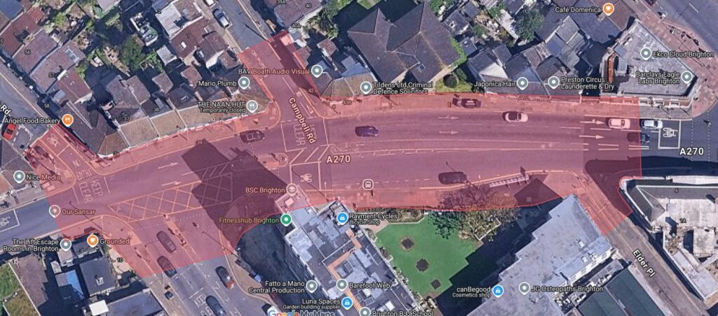
Topographical Surveys
Monument uses the latest high accuracy total stations, GPS and digital levels to determine fit for purpose control networks from which survey observations are taken. Data is processed using advanced survey software LSS from which client specified products can be outputted and delivered. This ranges from MX-Moss Genio text outputs to 3D AutoCAD drawings. All information can be exported to the client’s specific needs on layering and point coding etc.
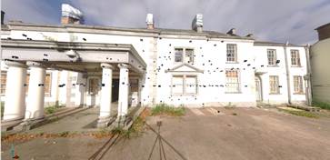
Measured Building Surveys
Monument are able to undertake large scale data acquisitions for internal floor plans and the surveying of building elevations to produce high quality and detailed AutoCAD drawings. This data can be used to create realistic and accurate models from which to design or evaluate further site developments. Accurate 3D measurements can be taken from the CAD drawings. These models are a flexible tool for visualising complex structures, inside and out.
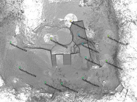
Laser Scanning
Monument can provide Bespoke Laser Scanning survey solutions. Our laser scanning survey capabilities enable us to survey remote or inaccessible areas, such as quarries, coastlines or busy roads without endangering personnel or affecting traffic flow. Utilising short, medium and long-range Laser scanning equipment, a range of applications and products can be extracted from the surveyed 3D point Cloud.
Underground Utility Surveys
These findings can then be marked up on site or overlaid onto a 3D/2D Topographical survey.
Monument can also provide drainage connectivity surveys which can be tailored to the project requirements and provide basic info such as chamber size, depth, pipe size, flow direction, condition etc.
All utility surveys can be undertaken to client supplied specification or PAS 128 Standards.
Recent projects
We draw on Monument’s expertise in: remote sensing, terrestrial laser scanning, geodesy and global positioning systems (GPS), 3D visualisation, high precision deformation monitoring, small inland hydrography and large-scale topographical mapping.